Live vehicle tracking: what it delivers and how to choose it
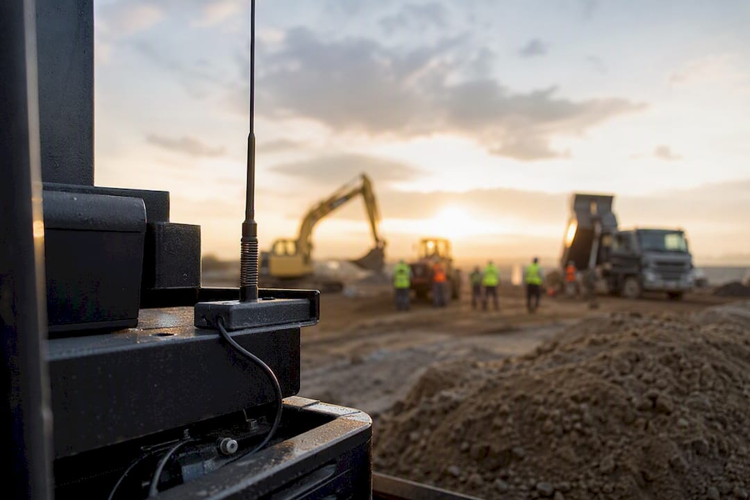
Live vehicle tracking shows you where every truck, ute and piece of machinery sits right now, so you can dispatch jobs, protect assets and account for work in progress without waiting for someone to call in. The technical term is a real time vehicle tracking system: GPS hardware paired with a connectivity layer and a dashboard that refreshes automatically. Before you sign with any vendor, check two things first:
- Update frequency (is it truly live, or just polling every minute?)
- Whether it integrates with your existing dispatch, payroll or compliance software
Get those two right and everything else, alerts, reporting, geofencing, tends to fall into place.
Key Takeaways
Reliable live vehicle tracking depends on update frequency, a low-latency data pipeline and integration with your existing dispatch and compliance systems, not just a feature list.
| Point | Details |
|---|---|
| Confirm true update frequency | Ask for exact seconds between fixes; “live” sometimes means 60-second polling in disguise. |
| Prioritise the data pipeline | MQTT and WebSocket push architectures cut latency versus older HTTP polling systems. |
| Match spec to use case | Theft recovery needs sub-10-second updates; general monitoring can run on 60-second tiers. |
| Pilot before you commit fleet-wide | Test 3 to 5 vehicles across urban, suburban and remote routes for 7 to 10 days first. |
| Choose integration over isolation | Dirtchamp links live GPS tracking directly to pre-starts, dockets and compliance records for truck and civil fleets. |
Table of Contents
- What live vehicle tracking actually gives a fleet
- How does live vehicle tracking actually work?
- Key features and specs worth demanding
- How do you choose the right vehicle tracking solution?
- Installing and integrating live tracking without disrupting operations
- What does live vehicle tracking cost?
- The core components behind any tracking system
- Common problems fleets hit during rollout (and how to fix them)
- Where live tracking has actually worked
- Frequently asked questions
- Sources
What live vehicle tracking actually gives a fleet
A working system does more than put a dot on a map. It gives your office and your drivers a shared, current view of operations, and it should pay for itself through fewer wasted callouts and faster billing cycles.
Expect these outcomes from a properly configured setup:
- A live map showing current position, speed and heading, with instant alerts for speeding, unauthorised movement or geofence breaches
- History playback and trip reports that double as billing and compliance evidence
- Driver behaviour telematics, harsh braking, idling, fuel burn, that flag coaching opportunities before they become claims
- Customer-facing tracking links and sharper ETAs, which cut down the “where’s my truck” phone calls
The real value shows up at the intersection of these features. A geofence alert means little without an accurate history log to back it up when a client disputes a delivery time. Fleets that treat live tracking as a dispatch tool and a compliance tool at once get more out of the same subscription.
How does live vehicle tracking actually work?
Every live vehicle tracking system follows the same rough path from satellite to screen, even though the specifics vary by vendor.
- A GNSS chip in the vehicle gets a position fix, usually accurate to a few metres.
- A communications module packages that fix and sends it over a cellular or satellite network.
- The data lands in a backend via an ingestion protocol, commonly MQTT for lightweight device traffic or HTTP for simpler setups.
- The backend pushes the update to your dashboard over a persistent connection, typically WebSocket, rather than making your browser ask for it.
- Map-matching software snaps the raw coordinate to the actual road, filtering out GPS drift that would otherwise show a truck driving through a paddock.
The protocol choice matters more than most buyers realise. Systems built on MQTT and WebSocket push can achieve sub-second to a few seconds of end-to-end latency in tested implementations, because the dashboard doesn’t sit around waiting to ask for an update. Older polling-based systems, where the app checks in every 30 to 60 seconds, will always lag behind, no matter how good the GPS hardware is.
Coverage is the other variable. Cellular networks handle most fleet tracking fine, but if your trucks run remote sites or off-grid civil jobs, you’ll need satellite-capable devices, and you’ll pay more for that reliability.
Key features and specs worth demanding
Not every “live” tracker is actually live. Some vendors use the word loosely to describe updates every 60 seconds, which is fine for general fleet visibility but useless for theft recovery or tight dispatch windows. Match the spec to the job:
- Dispatch and job coordination: updates every 10 to 30 seconds are usually enough
- Theft recovery or high value assets: you want sub 10 second updates, sometimes as frequent as every second
- General compliance monitoring: 60 second tiers are common and cheaper, as several vendors price them well below their high frequency options
Beyond frequency, look for device ruggedness (dust and vibration rating matters on civil sites), APIs and webhooks for pulling data into maintenance or payroll systems, and precise geofence controls with customisable alert rules. Diagnostic telematics, engine hours, fault codes, fuel level, are now standard on better hardware and feed straight into maintenance scheduling.
Pro Tip: Ask for the device’s average fix time when cold starting after being parked overnight. A device that takes two minutes to get a first fix will look “live” on paper but frustrate your morning dispatch every single day.
How do you choose the right vehicle tracking solution?
Feature lists all look similar in a sales deck. What separates a reliable system from a frustrating one only shows up once you push past the pitch.
- Run a live demo, not a recorded one. Watch the position update on screen in real time, not a pre-loaded animation.
- Trigger a geofence alert on the spot. Ask them to drive (or simulate) a vehicle across a boundary and time how long the alert takes to land in your inbox.
- Test route history playback. Confirm it shows the actual path driven, not a straight line between two points.
- Ask about the data pipeline. A vendor who can explain whether they use MQTT, polling, or something else, and why, understands their own product.
- Ask about SIM and network flexibility. Locked-in SIMs cause outages when one carrier drops coverage in a region you service.
- Check firmware update policy. Devices that never get firmware patches eventually fall behind on GNSS accuracy improvements.
- Get the commercial detail in writing: data caps, contract length, SLA response times, and what happens if a device fails in month two.
Red flags worth walking away from: vendors who can’t demonstrate real-time updates live, pricing hidden behind “call us,” and any answer that dodges how their system actually gets data from truck to screen.
Installing and integrating live tracking without disrupting operations
Roll it out in stages, not fleet-wide overnight. Start with three to five vehicles that cover a mix of conditions, an urban run, a suburban route, and at least one remote or low-coverage job, and run the pilot for one to two weeks. Measure update latency, missed fixes, false geofence alerts, and how long it takes data to land in your maintenance or payroll systems.
Installation choices affect both cost and disruption:
- OBD port plug-in devices install in minutes with no wiring, good for light vehicles and quick rollouts
- Hardwired units take longer to fit but suit heavy plant and machinery without an accessible OBD port
- Battery-powered trackers work for trailers, generators and equipment that isn’t always connected to vehicle power
Integration is where the real payoff sits. A tracker that only shows dots on a map is a novelty. One that feeds straight into your dockets, compliance records and billing turns location data into paperwork you don’t have to chase.
Dirtchamp was built around this exact problem in the truck and civil industry: GPS tracking that connects to pre-starts, dockets and site records without a complicated install, so supervisors get real-time visibility the moment a vehicle moves.
For a look at how real-time data changes decision-making beyond just tracking dots, construction operators increasingly rely on live dashboards to coordinate crews and materials on site.
What does live vehicle tracking cost?
Pricing usually runs as a per-vehicle monthly subscription on top of a one-off hardware cost. Expect the hardware to be the smaller line item over time; the recurring fee is what adds up across a fleet.
- Update frequency drives price. High-frequency “live” tiers (updates every 5 to 10 seconds) cost more per month than standard 60-second tiers.
- Satellite fallback adds cost. Devices covering remote routes with satellite backup carry a premium over pure cellular units.
- Watch for hidden extras: custom API integrations, SIM roaming charges for interstate work, and firmware or support service fees that aren’t in the headline price.
When comparing quotes, build a simple three-year total cost of ownership: hardware cost, plus (monthly fee × 36), plus any known integration or setup fees. A cheaper monthly rate with a costly integration fee can end up pricier than a slightly higher all-in offer.
The core components behind any tracking system
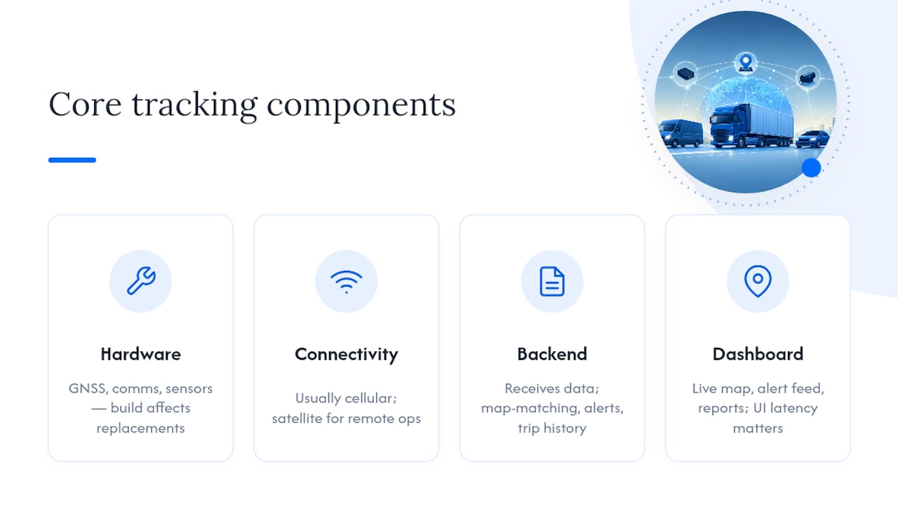
Every vehicle tracking system, regardless of brand, breaks down into the same four building blocks, and understanding them helps you ask sharper questions in a sales call.
Hardware is the device physically in the vehicle: a GNSS receiver for position, a communications module for transmission, and often extra sensors for fuel, temperature or engine diagnostics. Build quality here determines how many units you’ll be replacing in year two.
Connectivity is the network the device uses to send data, almost always cellular for standard fleet work, with satellite reserved for genuinely remote operations. This layer is where most reliability problems actually originate, a dropped cellular connection looks identical to a broken device from the dashboard’s point of view.
Backend is the server infrastructure that receives, stores and processes the incoming data. This is where map-matching happens, where alert rules get evaluated, and where historical trip data gets stored for later playback and reporting.
Dashboard is what you and your team actually see: the live map, the alert feed, the reports. A dashboard pushed by WebSocket feels instant; one that refreshes on a timer feels sluggish, even if the underlying data is identical.
Weakness in any one layer undermines the whole system. A brilliant dashboard fed by a device with poor GNSS accuracy is still an unreliable system, and a rock-solid device on a backend that can’t handle load during peak hours will drop updates exactly when you need them most.
Common problems fleets hit during rollout (and how to fix them)
Most live tracking headaches trace back to a handful of predictable causes.
Patchy updates in certain areas. Usually a cellular coverage gap, not a device fault. Cross-check the location against your carrier’s coverage map before assuming the hardware is faulty. If the vehicle regularly works that route, a satellite-capable unit or a different network SIM solves it.
False geofence alerts. Often caused by GPS drift near the geofence boundary rather than an actual breach. Widening the geofence buffer by a few metres, or requiring an alert to persist for two consecutive fixes before firing, cuts down false positives without missing real ones.
Delayed dashboard updates despite “live” specs. Check whether the vendor’s backend is actually pushing data (WebSocket) or whether your dashboard is polling on a timer. This is worth raising directly with support rather than assuming it’s a network issue.
Integration data mismatches. When tracking data feeds into payroll or maintenance systems, mismatched vehicle IDs or timestamp formats between platforms are the usual culprit, not the tracking device itself.
Driver resistance to monitoring. This is a change management issue more than a technical one. Framing the system around safety and fair time recording, rather than surveillance, tends to reduce pushback faster than any feature explanation.
Most of these issues surface in the first fortnight of a pilot, which is exactly why a short, deliberately stressed pilot beats a long, comfortable demo.
Where live tracking has actually worked
Civil contractors running plant across multiple sites use live tracking primarily for utilisation, knowing which excavator sat idle for three hours changes how the next job gets quoted. Combined with geofencing around site boundaries, it also flags when equipment leaves a job without authorisation, which matters on hired machinery.
Long-haul and regional trucking operations lean on history playback and driver behaviour data more than the live map itself. A dispute over a delivery time or a fuel claim gets resolved in minutes when the trip log is sitting right there, instead of relying on a driver’s memory or a paper docket.
Waste and recycling fleets, with dozens of short stops a day, use live tracking mainly for route verification and customer proof of service. A tracking link sent to a commercial client showing the truck arrived on schedule cuts down billing disputes considerably.
Civil and earthmoving businesses that combine tracking with digital dockets see the clearest office-side payoff: supervisors get real-time visibility into where trucks are and what work is being logged, without waiting for paperwork to come back at end of shift. That’s the pattern worth paying attention to, tracking alone tells you where a vehicle is; tracking tied to your records tells you what happened and why it matters for billing.
Author perspective: operational priorities from the field
Reliable updates and clean integration beat a long feature list every time… Start with a small pilot, prove the ROI, then scale.
How Dirtchamp brings live tracking into your daily operations
Most standalone GPS trackers give you a dot on a map and leave the rest of your operation, dockets, pre-starts, compliance, sitting in a separate system you still have to manage by hand. Dirtchamp connects GPS vehicle tracking directly to the paperwork your office already relies on, so a truck’s location and its docket live in the same platform.
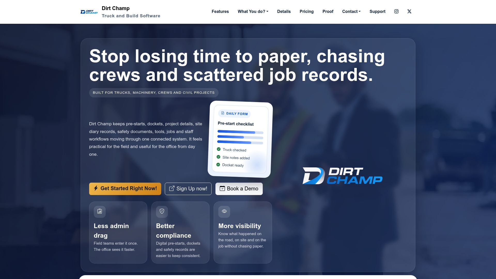
Installation doesn’t require rewiring your fleet or scheduling a workshop day. Dirt Champ connects via the OBD port, giving supervisors real-time visibility into vehicle location alongside pre-starts, dockets and compliance records the moment a job starts. Reporting and billing pull straight from the same live data, so there’s no re-entering trip details into a separate accounting system at month end. For a truck or civil business trying to cut paperwork and gain live visibility without running two disconnected platforms, that combination is the practical difference. If that sounds like what your operation needs, book a demo with Dirtchamp and see how it fits your current workflow.
Frequently asked questions
What counts as “real time” in live vehicle tracking? Most vendors consider updates every 5 to 10 seconds genuinely live, while 60-second intervals are marketed as live but function more like frequent polling.
Does live vehicle tracking need satellite connectivity? Only if your vehicles regularly work areas without cellular coverage. Cellular networks handle the vast majority of fleet operations reliably and at lower cost.
Can live tracking data feed into payroll or compliance software? Yes, provided the vendor offers APIs or webhooks. This is worth confirming before purchase, since bolt-on integrations after the fact are often costlier and slower to implement.
How long should a tracking pilot run before committing? Seven to fourteen days across a mix of routes, including one remote or low-coverage area, gives enough data to spot latency issues, missed fixes and false alerts.
Does live tracking help with fuel and driver behaviour, not just location? Yes. Telematics data such as harsh braking, idling and fuel burn is standard on modern devices and feeds directly into maintenance and driver coaching decisions.
Sources
- Vehicle tracking system — Wikipedia
- real-time-vehicle-tracking-system-v2.0 — GitHub
- Real-Time Fleet Visibility: Live GPS Tracking & Sensor Monitoring | Navixy
- Live GPS Vehicle Tracking | Real-Time GPS Trackers | LiveViewGPS
- Vehicle Tracking Device | Fleet GPS Trackers | Geotab